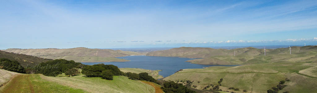
Los Vaqueros Reservoir
Los Vaqueros reservoir is operated by the Contra Costa Water District (CCWD). Much like nearby Del Valle Lake (maintained by EBRPD), the reservoir supports various recreational activities like boating, fishing, picnicking, and hiking. Being a source of potable water, swimming and pets are not allowed in the area.
Note that there are two entrances within the park that do not connect: in order to drive to the other side, you’ll need to exit and drive ~45mins on Vasco.
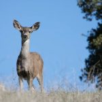
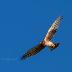
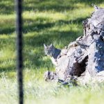
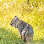
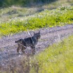
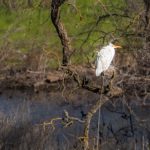
The area supports various wildlife including bobcats, raptors, coyotes, and egrets. The hikes here vary in difficulty from gentle, flat strolls along the lakeside to steep rolling hills.
Los Vaqueros Essential Info
Hours:
September 7 a.m. to 7 p.m.
October 7 a.m. to 6 p.m.
Nov. – Feb. 7 a.m. to 5 p.m.
March 7 a.m. to 6 p.m.
April-August 6 a.m. to 8 p.m.
Parking Cost: $6, $5 Seniors, $4 CCWD customers.
Website: https://www.ccwater.com/9/Los-Vaqueros
Getting There
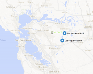
There are two entrances separated by about 45 minutes, so make sure to pick the right one!
The northern, Brentwood entrance provides access to the John Muir Interpretive center while the southern, Livermore, entrance provides access to the marina. The link on the map to the right will bring you to the south entrance. For a link to the northern entrance (and through to the interpretive center), click here.
From the Walnut Creek, Concord, and Antioch areas of the easy bay, the fastest way is probably via Highway 4 West to Vasco.
If coming from other parts of the bay area, take 580E and exit Vasco road in Livermore.
Trails
Kellogg Creek Trail
Length: ~5 miles (in and out)
Time: 2.5 hours
Difficulty: Easy
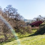
Located on the north side of the lake, this trail follows Kellogg creek to the John Muir Interpretive center. From there, it’s a short but steep climb up a paved road to the the top of the dam with access to several other trails.


Black Hills to Cañada Trail loop
Length: ~7 miles
Time: 3.5 hours
Difficulty: Moderate
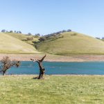
Shifting to the south side, this trail brings you up in the hills with sweeping views of the reservoir with good opportunities to see raptors.
Los Vaqueros Trail
Length: Variable
Time: Variable
Difficulty: Easy
Also located on the south side, this trail starts from the marina and roughly follows the lake’s shoreline. You’ll hike past peaceful coves and migrating birds resting within.
Alternates
Nearby Brushy Peak, on the southern end of Vasco Road is home to many raptors due to the abundance of mice, squirrels and rabbits.
You must be logged in to post a comment.