Sunol Regional Wilderness – Something for Everyone
Sunol Regional Wilderness Essential Info
Facilities: Visitors Center and vault toilets.
Hours: 8AM-5PM (winter) 8AM-7PM (and later depending on month)
Dogs: $2 fee.
Parking: $5 per vehicle
More Info: East Bay Parks Website
The site says there’s no drinking water, but they often serve water out of drinking jugs near the visitor’s center.
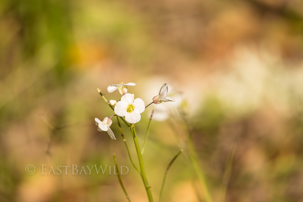
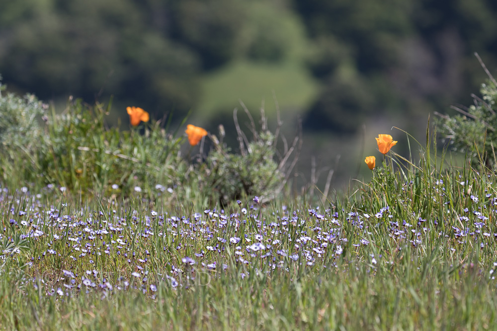
Seasonal Note: Like many East Bay parks, Sunol Wilderness can be extremely hot and exposed during the summer. The longer hikes are best avoided during this time of year. Spring is the best time, offering wild flowers, flowing creeks, and milder temperatures.
Highlights
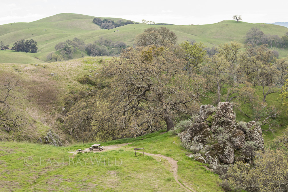
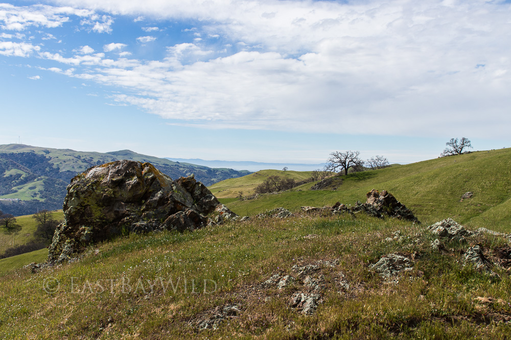
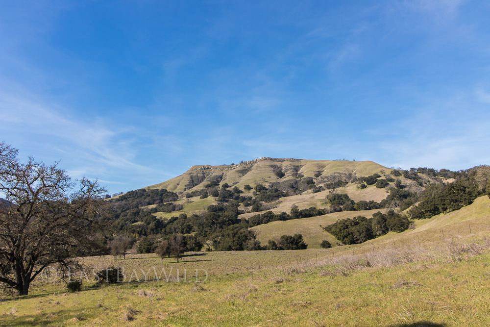
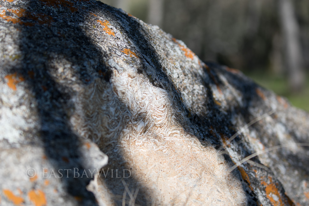
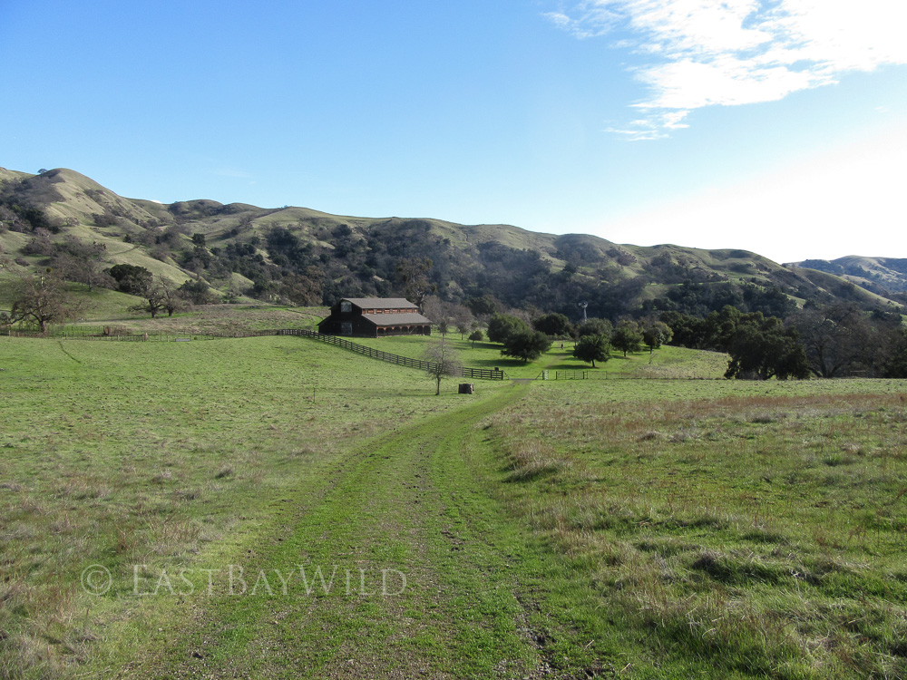
Sunol Regional Wilderness has something for everyone: views, waterfalls, canyons, streams, and climbable boulders are some of the things you’ll find here.
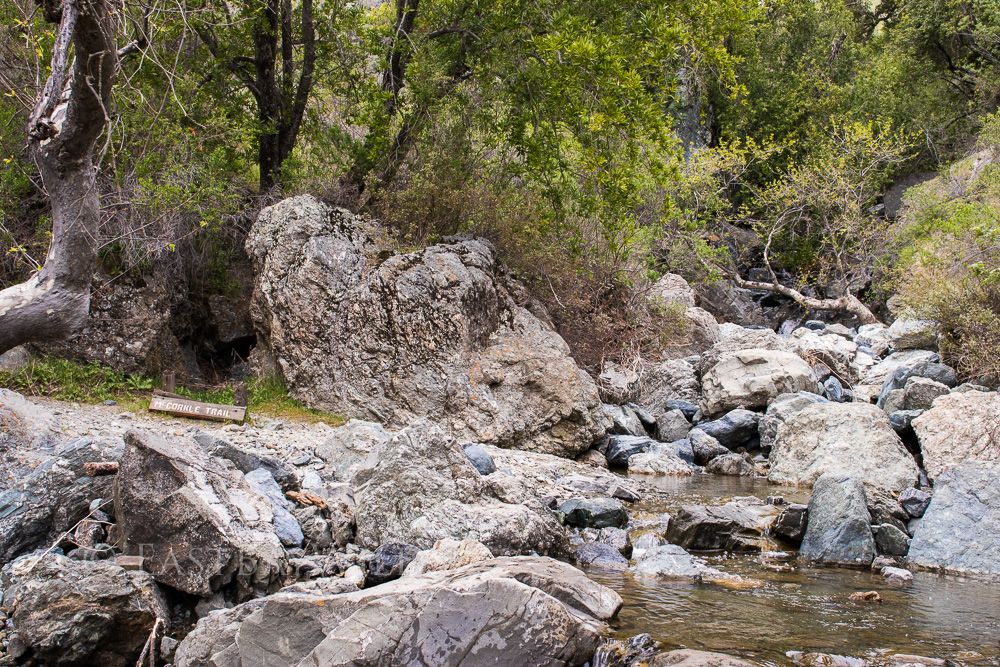
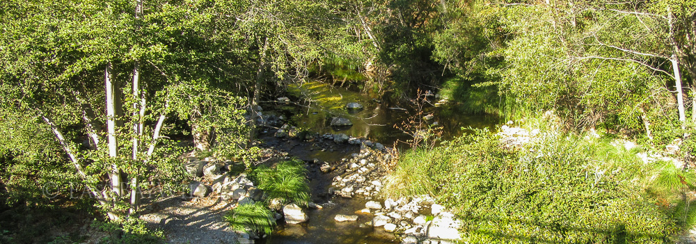
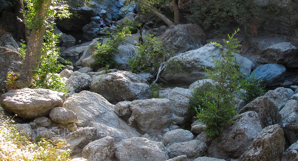
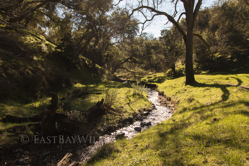
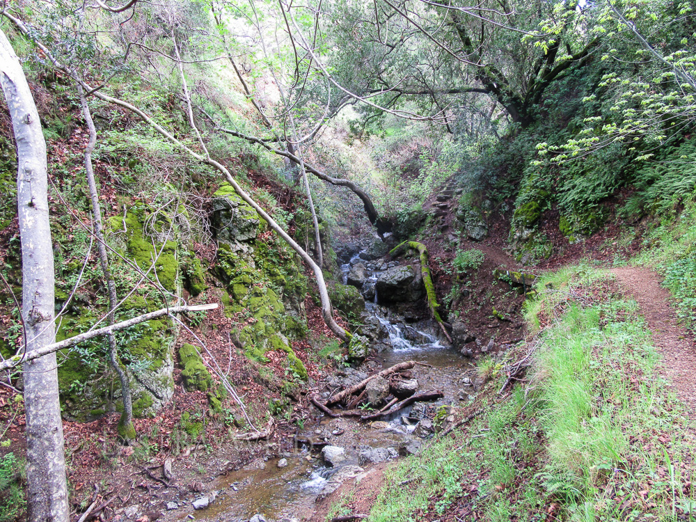
The most popular destination is Little Yosemite which sports a small canyon with giant granite boulders and gushing rapids (during spring) of the Alameda Creek.
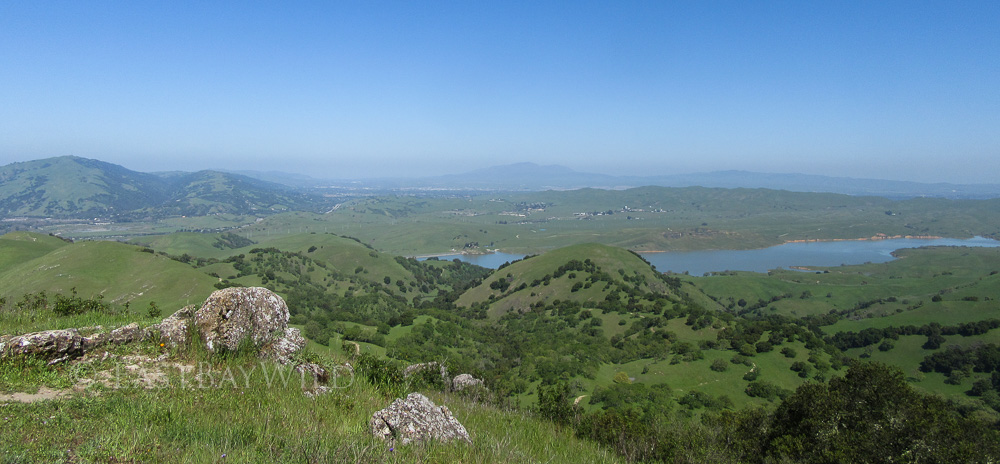
The Flag Hill trail offers breathtaking views of the surrounding areas with several return route options.
Other routes include the Eagle View Trail and camping along the Ohlone Wilderness Trail up to Del Valle Lake.
Getting There
 Access the park via 680. From the South bay, take 680N to Calaveras/84-W off ramp and make a right onto Calaveras Road.
From the northern bay areas, take 680S to the Calaveras Road/84 Dumbarton Bridge exit. Make a left onto Calaveras Road. Note that the preceding exit is labeled “Sunol” and is not the correct exit.
Stay on Calaveras Road for 4.3 mi. Along the way, you’ll come across a couple of plant nurseries, a construction aggregates facility,and a water treatment plant along the southern side of the road. The road is also popular with bicyclists.
At approximately 4.3 mi, make a left onto Geary Road. At the time of this writing, Calaveras Road is closed beyond Geary road making this turn really hard to miss.
Geary Road will eventually lead to an entrance gate and ranger booth that will provide a park map in exchange for the vehicle entry fee.
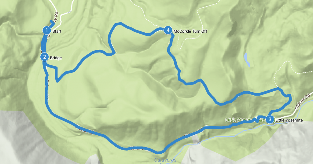
Little Yosemite
Total climbing: 469 ft
Length: 2.7 mi
Time: 1.5 hr
Difficulty: Easy
The most popular destination in the Sunol Regional Wilderness, the most direct route is to park at the end of Geary road (past the visitor center and the horse corral) as close to the bathroom as possible. The Camp Ohlone Road starts here, immediately crossing the Alameda creek.
Checkpoint: Bridge
Checkpoint: Little Yosemite
From here, the dirt road follows a gradual incline up to a picnic area with an outhouse. Follow the dirt paths down the creek side to get a better view of the Little Yosemite features.
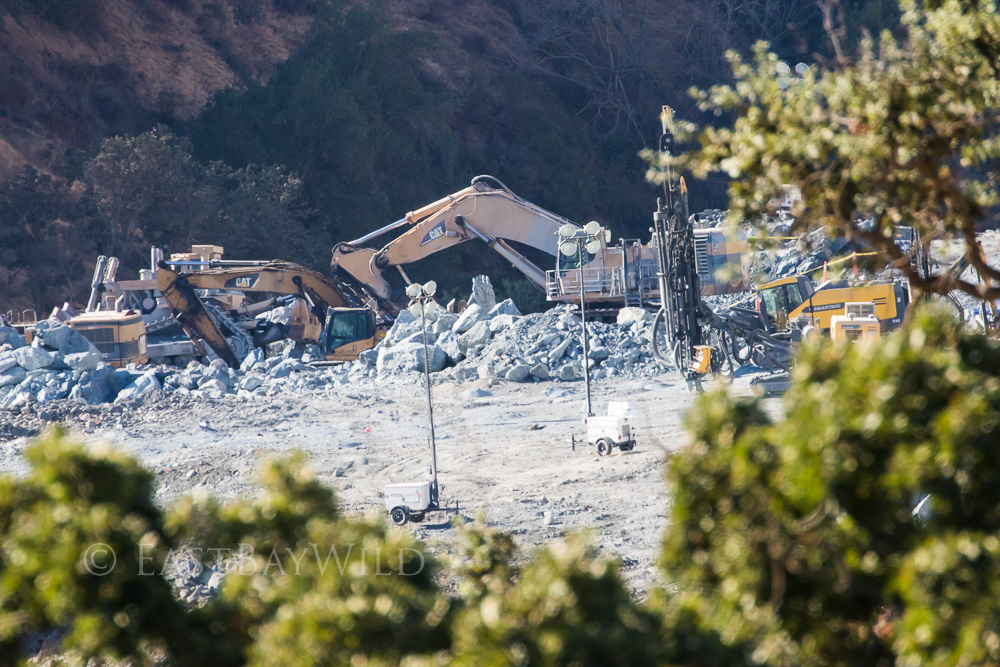
To return back to the parking lot, you can either follow the road straight back (easiest) or proceed through the picnic area to take the Canyon View Trail to the McCorkle trail. Along the way, you’ll likely glimpse the work being done on the Calaveras Dam replacement project. Calaveras and nearby San Antonio reservoirs are maintained by the SF Water Department and serve as part of the Hetch Hetchy water system.
Checkpoint: McCorkle Trail turn off
Taking the left hand side trail will bring you down McCorkle trail and back to the Ohlone Camp Road. As an alternative, you can also continue along Canyon View trail which will bring you to the visitor’s center area.
Flag Hill Trail
Total climbing: 1565 ft
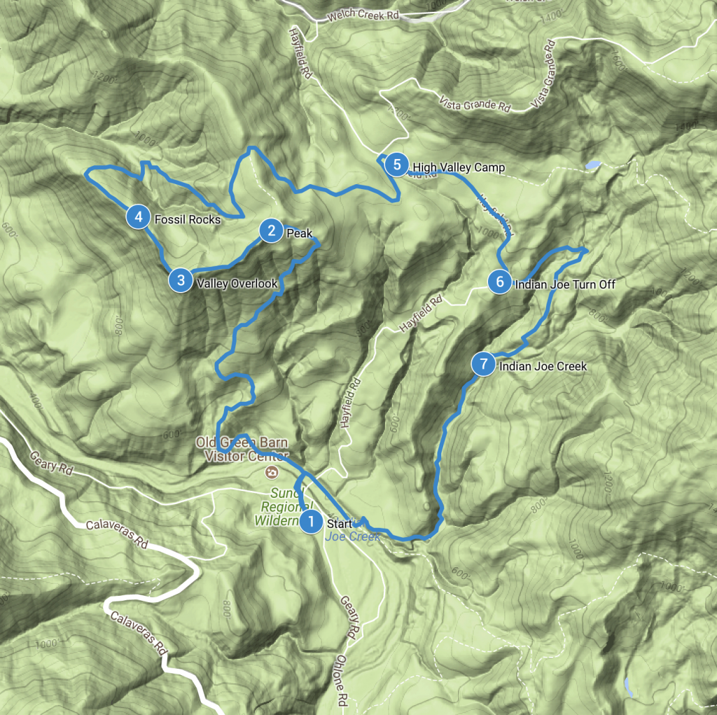
Length: 5 mi
Time: 3 hrs
Difficulty: Moderate (Steep)
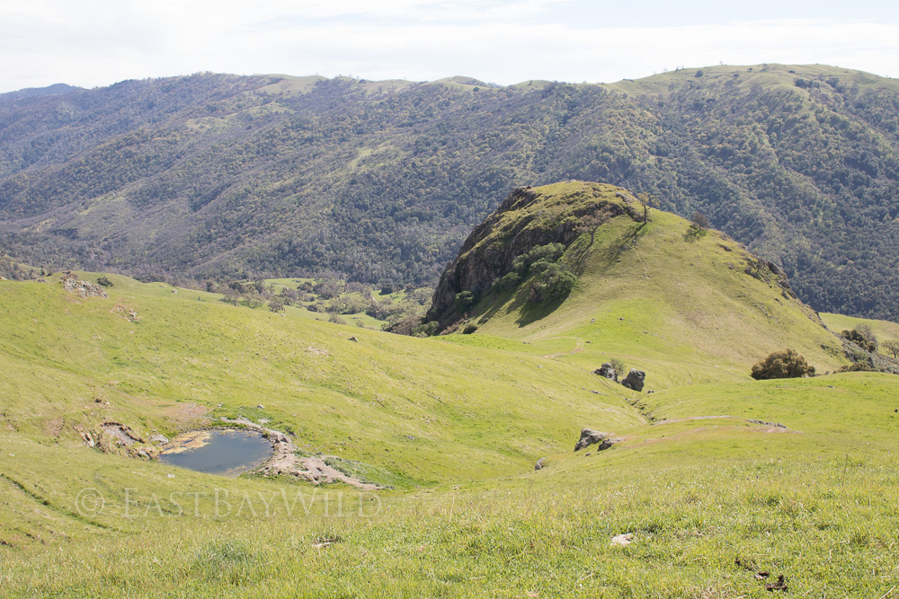
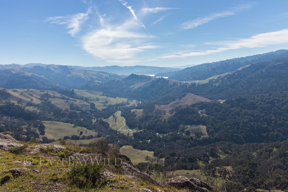
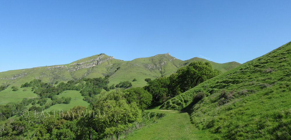
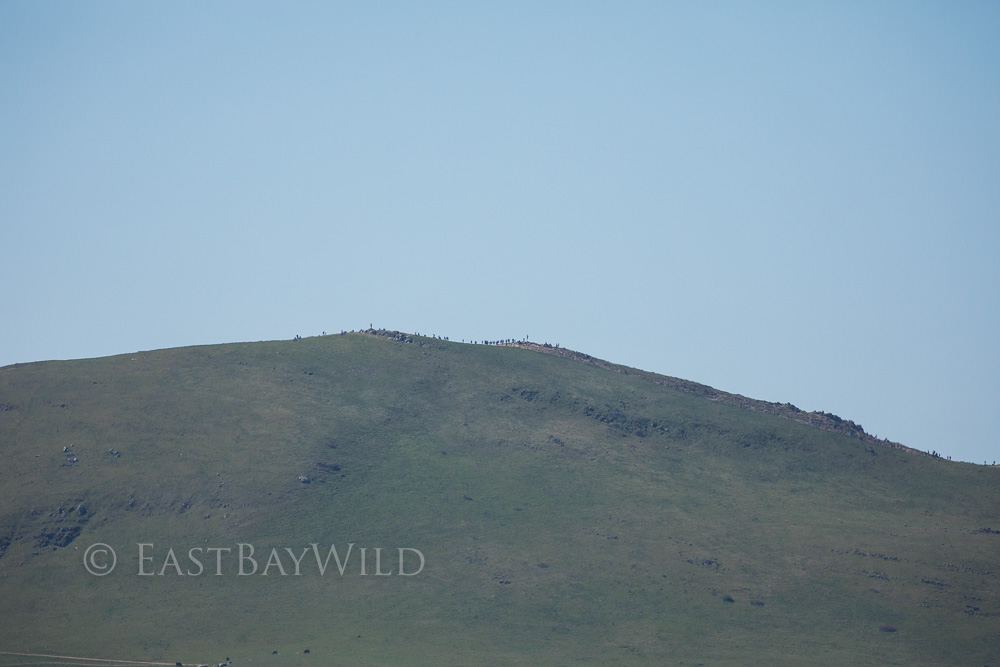
The rocky cliffs topping Flag Hill are an intimidating sight for anyone attempting this trail. While the climb will keep your quads burning, the trek to the top is short. Before you think you won’t be able to go any further, you’ll find yourself at the top, looking over the grand views over the valley floor.
Start at the visitors center, crossing the Alameda Creek bridge. Proceed left (west) along the Canyon View trail and turn right (north) at the Flag Hill Trail trail sign. The trail will immediately begin ascending, zig-zagging its way up the side of flag hill.
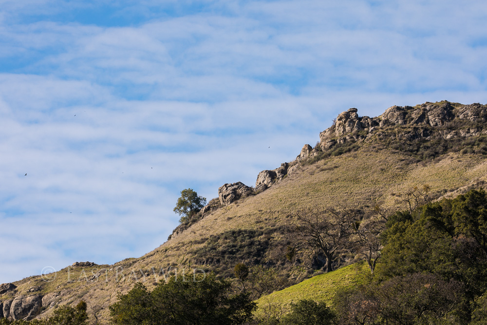
Just before the top, a rocky, narrow section requires a little balance and caution. Once past this, a wide, barely inclined path leads up to the peak.
Checkpoint: The Peak
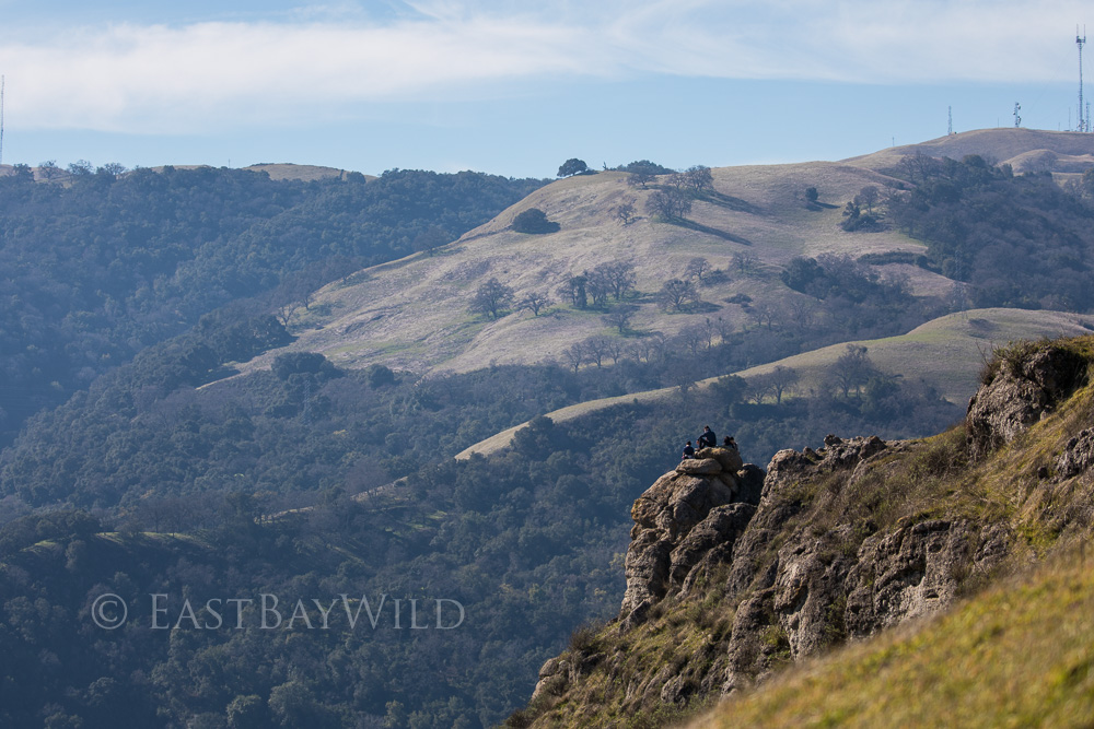
Checkpoint: The Overlook
Proceed just a few yards past the peak onto the Flag Hill loop trail where you’ll catch better views of the valley below.
Checkpoint: Fossil Rocks
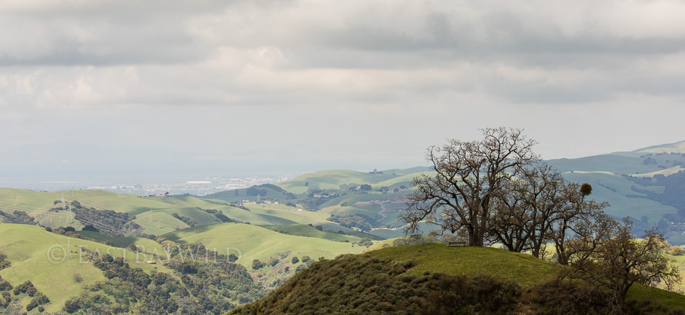
At the top of Flag Hill is Flag Hill Loop Trail. This short but deceptive trail offers more views westward towards the bay and of the MacGuire Peaks. Bear in mind that this loop descends quite a bit before ascending (rather abruptly) back to the top.
Checkpoint: High Valley Camp
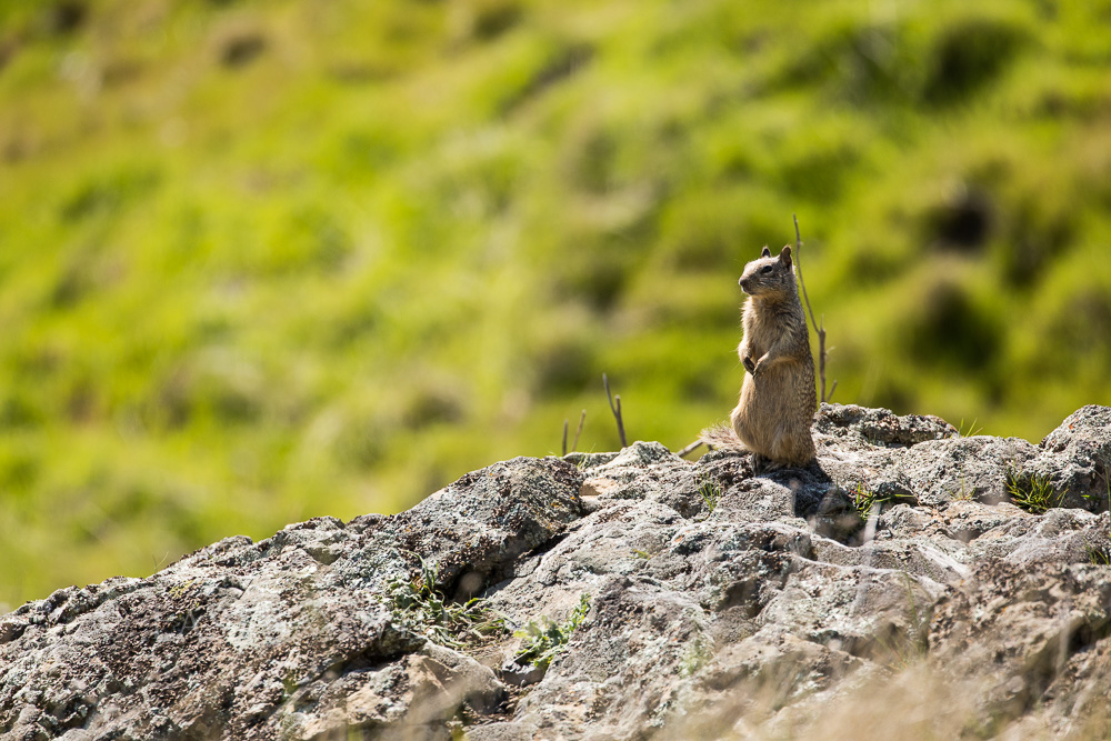
The Flag Hill marker designates the intersection of the trail and Flag Hill Road. Take this road north, going away from the valley and descending behind a hillside. After a few switchbacks and a fallen oak tree popular with the squirrels, you’ll come across Hayfield Road and the High Valley camp.
Checkpoint: Indian Joe Turn Off
Hayfield road will continue back to the visitors center. However, if you prefer a more shaded route to return by (recommended), look for a signed intersection on the left hand side about a quarter mile past High Valley camp. The turn off with double back along a hillside before crossing a stream and placing you on the Indian Joe Trail just below the Cave Rocks.
The shade on the Indian Joe Trail makes for a more comfortable return trip and provides for greener surroundings.
Checkpoint: Indian Joe Creek
From here, continue to descend along the Indian Joe Trail where you’ll meet the Canyon View trail and head right (west) back to the visitor’s center.
Eagle View trail (via Welch Creek Road)
Total climbing: 909 ft
Length: 3.0 mi
Time: 2 hrs
Difficulty: Moderate (Steep)
The Eagle View trail has a few ways to access it. It’s a possible return route from the Flag Hill trail (via Vista Grande road near High Valley camp), or it can start from the lesser known Welch Creek Road.
Welch Creek Road
This easily overlooked entrance to the Sunol Regional Wilderness is located a few hundred feet before the main turn off at Geary Road. Before using this entrance, take note that the vehicle fee is still required so you’ll either need an annual park pass or go through the main entrance gate first to pay the fee. The parking lot at the 2.2 mile marker is a good access point to the Eagle View trail.
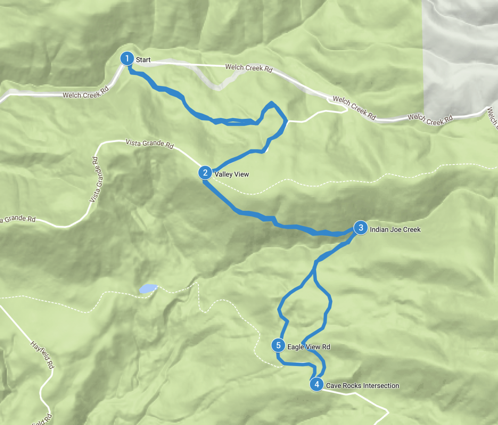
The Eagle view trail starts at the 2.2 mile marker, winding its way upwards through tall grass and underneath old oak trees. Ascending up the ridge, you’ll catch views of the MacGuire Peaks. At the top intersection with Vista Grande Road you’ll be greeted with splendid views of the Sunol Wilderness valley and Calaveras Reservoir.
Checkpoint: Valley View
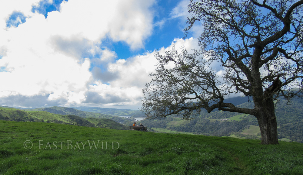
Proceeding along Eagle View trail, you’ll pass a warning sign indicating that the trail is narrow and has a steep drop-off alongside. The trail traverses the ridge just below Vista Grande Road, allowing for unobstructed views of the valley below.
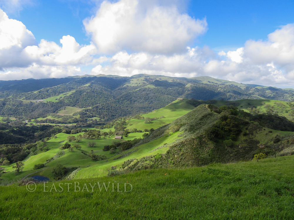
Aptly named, the higher elevations and location along a ridge where updrafts are found bring in raptors looking for an easy ride.
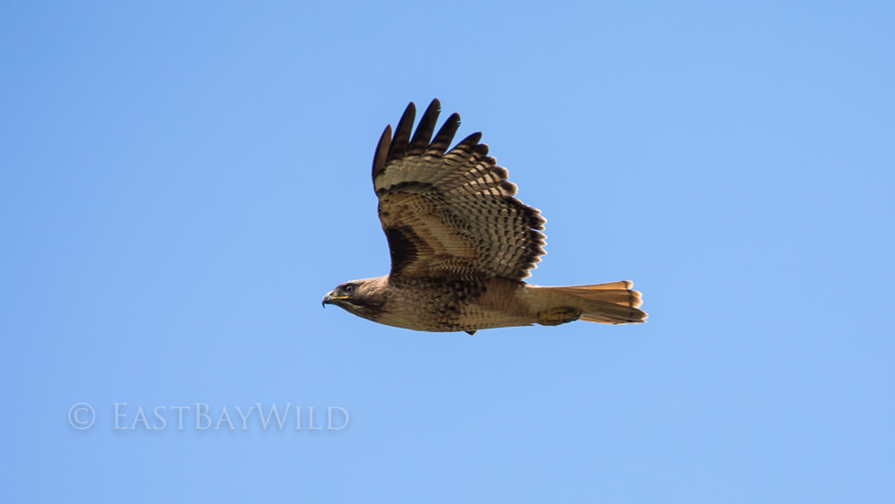
Checkpoint: Indian Joe Creek
After traversing the ridge, you’ll run into the upper Indian Joe Creek which provides a temporary change of scenery.
Checkpoint: Cave Rocks Intersection
The trail will split into Eagle View trail and Eagle View road. Veer left to take the Eagle View trail to the Cave Rocks road intersection, demarcated by a bench. From here, proceed right (west) for a short distance along Cave Rocks road.
Checkpoint: Eagle View Road
After only a short distance, make a right onto Eagle View road. This brings you back to where you split to Eagle View trail. Retrace your steps through Indian Joe Creek, back across the ridge, and eventually back to Welch Creek Road.
Taking the same trail back provides amazing views from another perspective.
MacGuire Peaks Loop
Total climbing: 1663 ft
Length: 6.5 mi
Time: 4 hrs
Difficulty: Moderate (Steep)
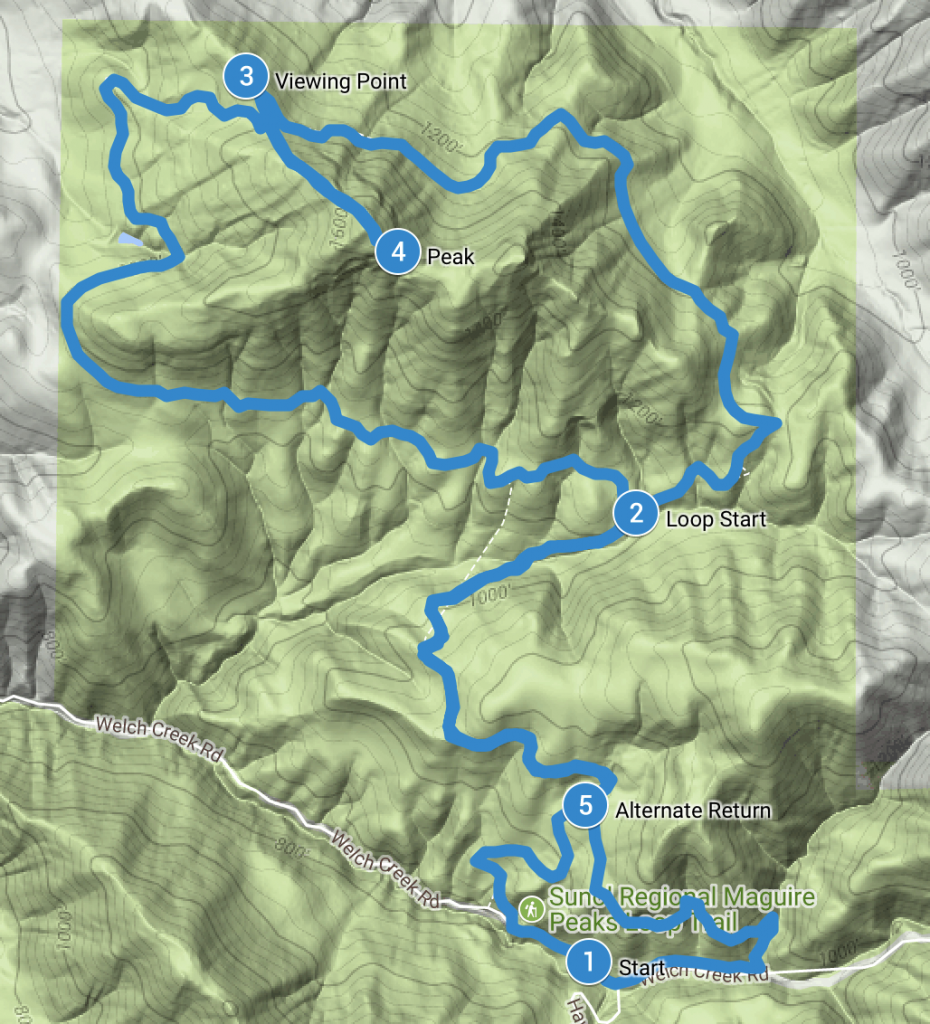
The MacGuire Peaks trail begins from the Welch Creek Road entrance to the Sunol Regional Wilderness at approximately the 1.6 mile marker. There’s an earlier entrance that’s located about 1/8 mi. earlier, just before the gated High Valley Road turn off which is well marked and offers a few spaces for parking. After parking, proceed down the road, looking for the trail head on the right hand side.
The trail begins with an in an ascent towards the loop that encircles the peaks.
Checkpoint: Loop Start
At the intersection with the loop proceed straight to acend the trail on the northern side of the peaks.
Checkpoint: Viewing Point
Along the trail at the base of the western peak is a bench that provides a great opportunity for a light snack and take a break from the trail.
Checkpoint: Peak
Although not part of the official trail, there’s a spur that allows you to ascend to the top of the western peak. This climb is extremely steep can be difficult for both the ascent and descent.
After visiting the peak, the main trail begins to descend, returning to the start and completing the loop.
Checkpoint: Alternate Return Route
After returning about 2/3 on the loop approach, you can veer left and take an alternate route back to the start. The alternate will take you about 1000ft further up Welch Creek Road from the parking area. This route offers a more covered trail and a small creek crossing right before hitting Welch Creek Road.
Ohlone Wilderness Trail
Length:19mi (to Rose Peak)
Time: 10hrs (to Rose Peak)
Difficulty: Hard (Elevation and Length)
Cost: $2 for a 1yr permit (available at the Sunol Regional Wilderness entry gate, comes with a map)
Note: Bring plenty of drinking water or a filter. There are water spigots at camp spots along the way but they only provide untreated water.
The Ohlone Wilderness Trail is a 29.1 mile trail that runs from Mission Peak in Fremont to Del Valle Lake in Livermore. From Sunol, a popular goal is Rose Peak which is the highest peak in Alameda county at 3817 ft (Mission Peak is only a paltry 2516 ft). An alternate day trip on the Ohlone Wilderness Trail is a 12.3 mi. hike that starts from Del Valle Lake to see the Murieta Falls in the spring time.
Unless you’re planning to camp, this trail is strictly an in-out trail. Hike as far out as you desire, taking time to return into consideration.
Start this hike from the horse corral parking area near the visitor’s center where there’s a sign-in sheet for the Ohlone Wilderness Trail located at the information panel. Take the bridge across Alameda Creek and make a right onto the Canyon View trail. Veer left and ascend onto the McCorkle Trail. Follow this trail for about 2.5 mi where you’ll hit the Sunol Backpacking Camp Area.
From here the Ohlone Wilderness trail will bring you up and down through an isolated back country and magnificent landscape.