Sunol Regional Wilderness – Flag Hill Trail
Flag Hill Trail Essential Info
Total climbing: 1565 ft
Time: 3 hrs
Difficulty: Moderate (Steep)
Facilities: Visitors Center and vault toilets.
Hours: 8AM-5PM (winter) 8AM-7PM (and later depending on month)
Dogs: $2 fee.
Parking: $5 per vehicle
More Info: East Bay Parks Website
The site says there’s no drinking water, but they often serve water out of drinking jugs near the visitor’s center.
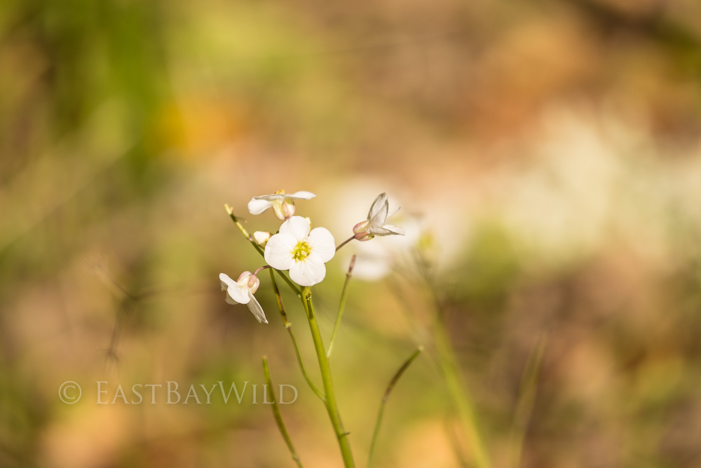
Seasonal Note: Like many East Bay parks, Sunol Wilderness can be extremely hot and exposed during the summer. The longer hikes are best avoided during this time of year. Spring is the best time, offering wild flowers, flowing creeks, and milder temperatures.
Highlights
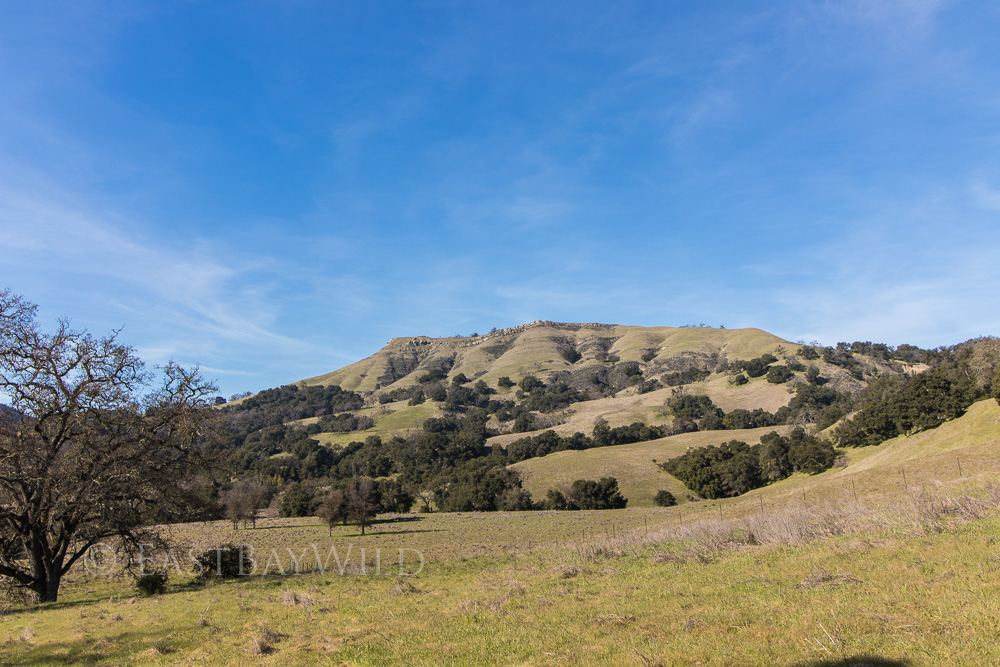
Flag Hill towers above the valley floor offering breathtaking views of the surrounding areas. The trail is steep but quick to reach the peak and has various return route options.
Getting There
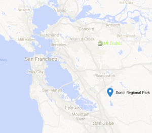 Access the park via 680. From the South bay, take 680N to Calaveras/84-W off ramp and make a right onto Calaveras Road.
From the northern bay areas, take 680S to the Calaveras Road/84 Dumbarton Bridge exit. Make a left onto Calaveras Road. Note that the preceding exit is labeled “Sunol” and is not the correct exit.
Stay on Calaveras Road for 4.3 mi. Along the way, you’ll come across a couple of plant nurseries, a construction aggregates facility,and a water treatment plant along the southern side of the road. The road is also popular with bicyclists.
At approximately 4.3 mi, make a left onto Geary Road. At the time of this writing, Calaveras Road is closed beyond Geary road making this turn really hard to miss.
Geary Road will eventually lead to an entrance gate and ranger booth that will provide a park map in exchange for the vehicle entry fee.
The Trail
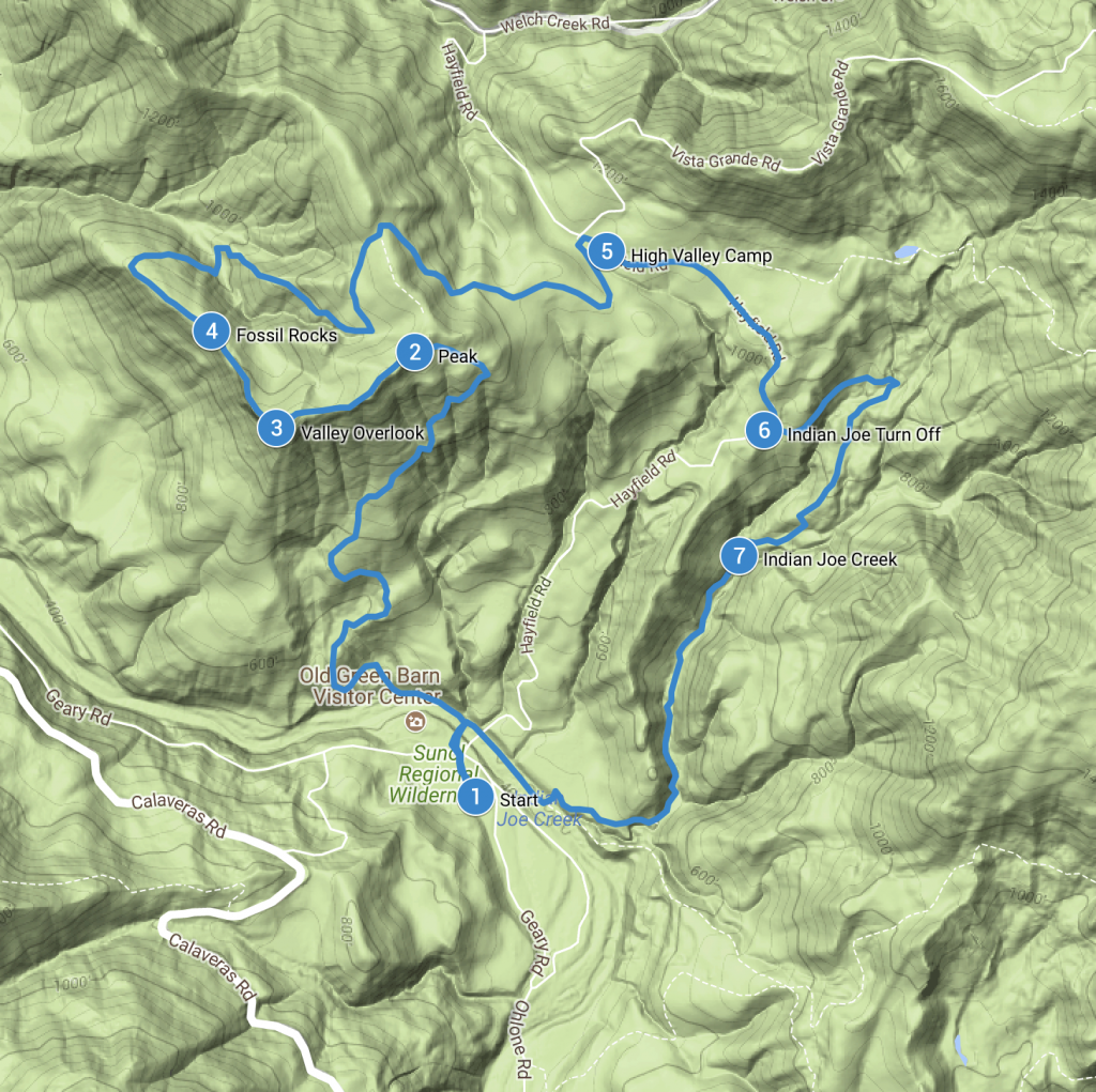
The rocky cliffs topping Flag Hill are an intimidating sight for anyone attempting this trail. While the climb will keep your quads burning, the trek to the top is short. Before you think you won’t be able to go any further, you’ll find yourself at the top, looking over the grand views over the valley floor.
Start at the visitors center, crossing the Alameda Creek bridge. Proceed left (west) along the Canyon View trail and turn right (north) at the Flag Hill Trail trail sign. The trail will immediately begin ascending, zig-zagging its way up the side of flag hill.
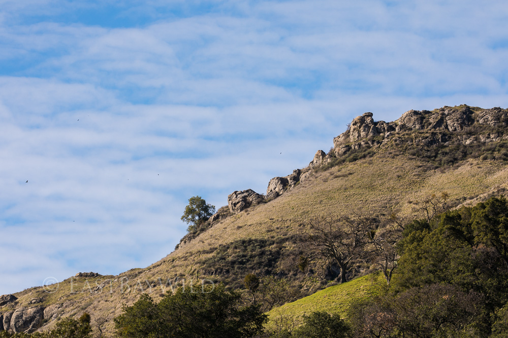
Just before the top, a rocky, narrow section requires a little balance and caution. Once past this, a wide, barely inclined path leads up to the peak.
Checkpoint: The Peak
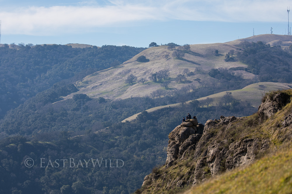
Checkpoint: The Overlook
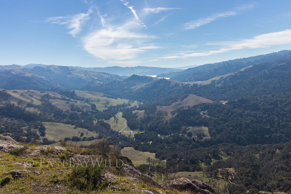
Proceed just a few yards past the peak onto the Flag Hill loop trail where you’ll catch better views of the valley below.
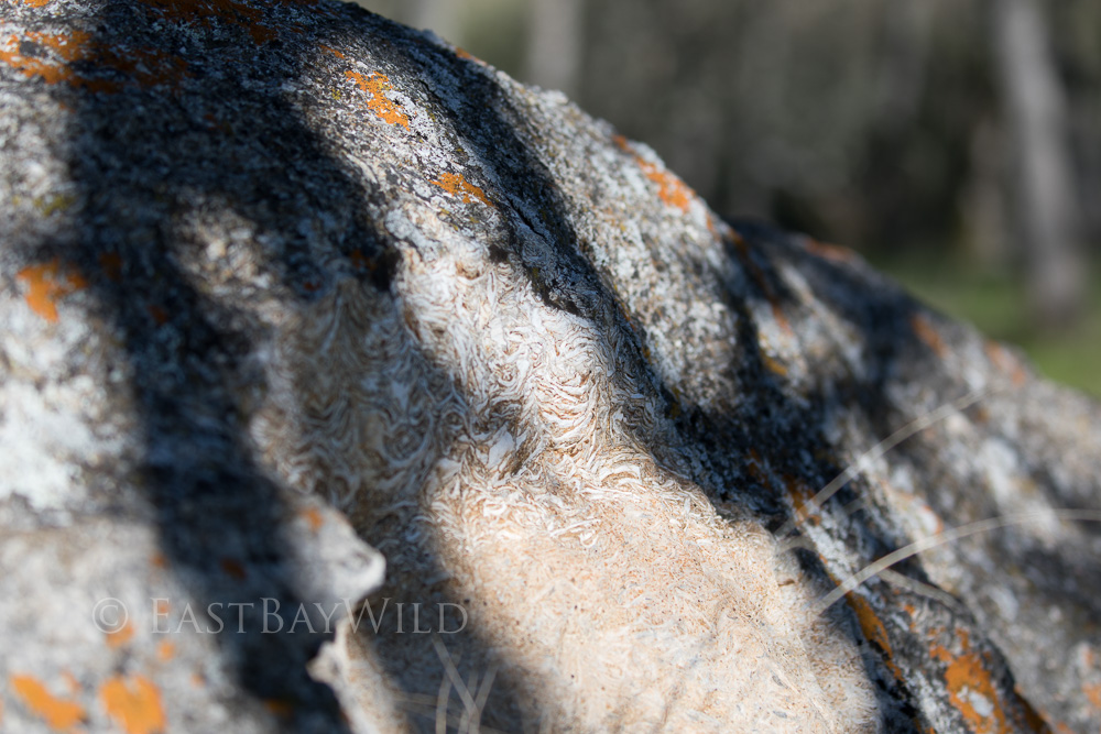
Checkpoint: Fossil Rocks
At the top of Flag Hill is Flag Hill Loop Trail. This short but deceptive trail offers more views westward towards the bay and of the MacGuire Peaks. Bear in mind that this loop descends quite a bit before ascending (rather abruptly) back to the top.
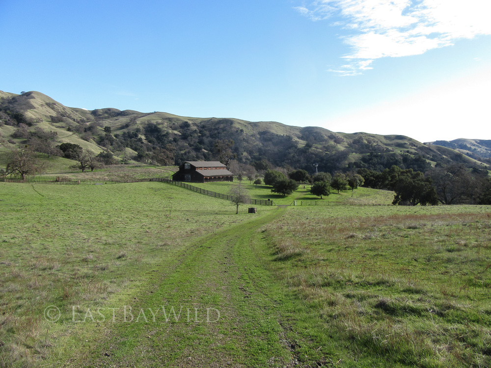
Checkpoint: High Valley Camp
The Flag Hill marker designates the intersection of the trail and Flag Hill Road. Take this road north, going away from the valley and descending behind a hillside. After a few switchbacks and a fallen oak tree popular with the squirrels, you’ll come across Hayfield Road and the High Valley camp.
Checkpoint: Indian Joe Turn Off
Hayfield road will continue back to the visitors center. However, if you prefer a more shaded route to return by (recommended), look for a signed intersection on the left hand side about a quarter mile past High Valley camp. The turn off with double back along a hillside before crossing a stream and placing you on the Indian Joe Trail just below the Cave Rocks.
The shade on the Indian Joe Trail makes for a more comfortable return trip and provides for greener surroundings.
Checkpoint: Indian Joe Creek
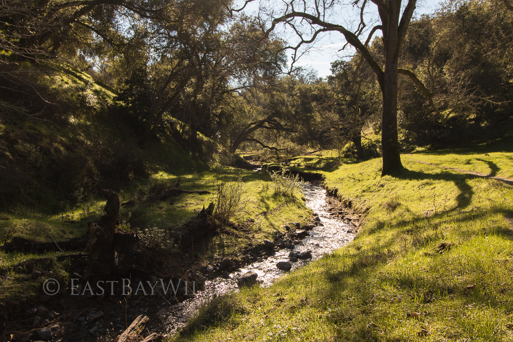
From here, continue to descend along the Indian Joe Trail where you’ll meet the Canyon View trail and head right (west) back to the visitor’s center.
You must be logged in to post a comment.