Pinnacles National Park – Loop starting at Bear Gulch
Pinnacles National Park, recently elevated from national monument status, became the United States’ 59th national park on Jan 10, 2013. The site of an ancient lava flows and tectonic plate shifting, it’s varied terrain and geologic formations provide a unique hiking backdrop.
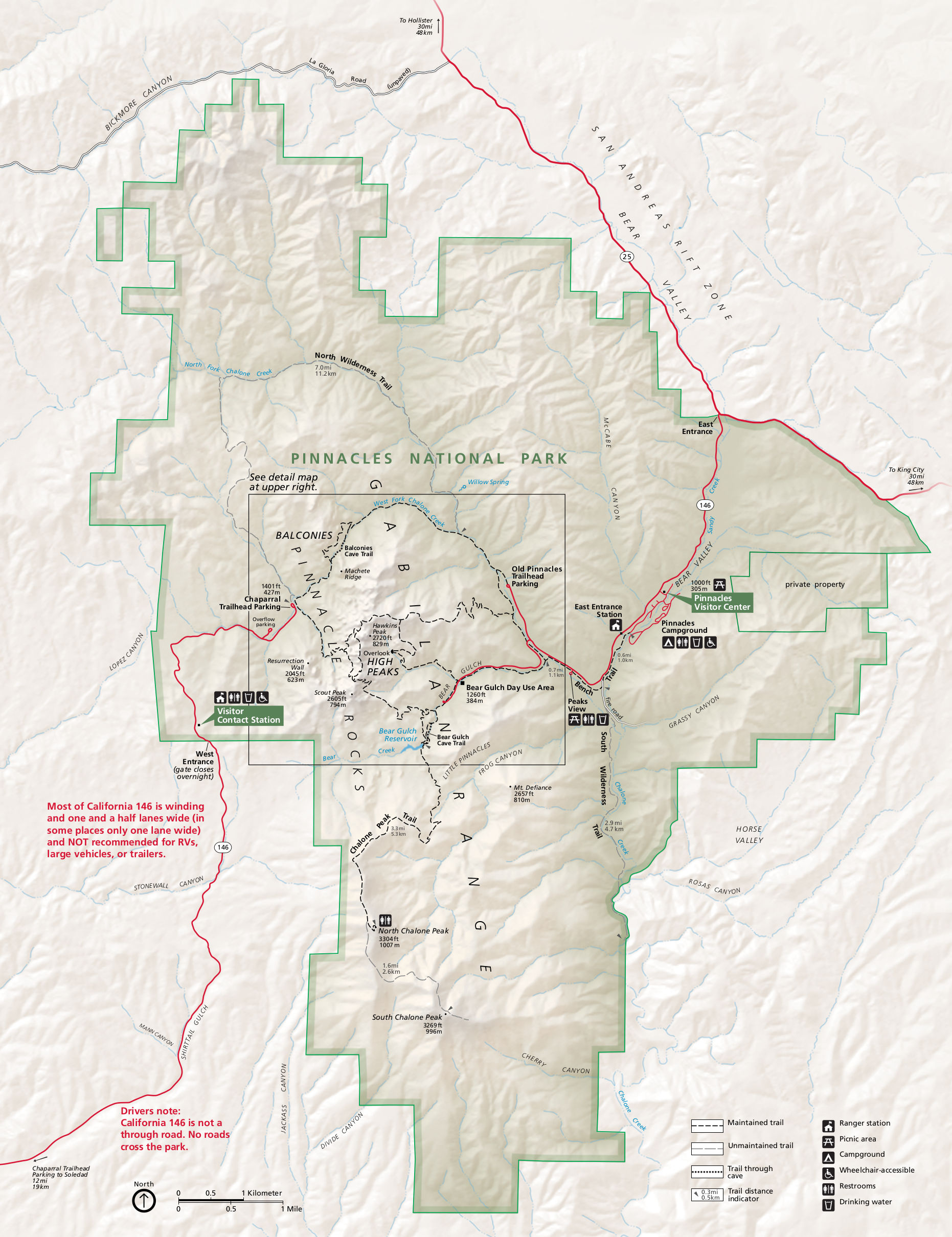
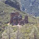
Bear Gulch – High Peaks – Old Pinnacles Loop trail
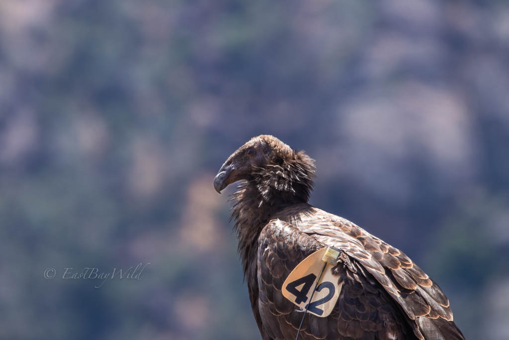
This trail will bring you through the highlights of Pinnacles. Starting out in Bear Gulch, you’ll go through the Bear Gulch caves, emerging at the picturesque Bear Gulch Reservoir. Then you’ll ascend into the High Peaks amongst the uniquely eroded spires that give Pinnacles its name and are frequented by the endangered California Condor. From the peaks, you’ll descend to the Chaparral trailhead where the hike flattens out. You’ll then pass through the Balconies Caves along the Chalone Creek on your way back to the Bear Gulch trailhead.
Total climbing: 5023 ft
Pinnacles National Park Essential Info
Length: 10 miles
Time: 6 hours
Total Elevation Gain: 3400 feet
Difficulty: Hard (Steep and narrow. Length and elevation gain)
Entrance Fee: $25/vehicle, $20/motorcycle, $12/walk-in
Hours: East side is always open, West side entry gate is 7:30am – 8:00pm. Exit is always open.
Website: https://www.nps.gov/pinn/index.htm
Map: http://npmaps.com/wp-content/uploads/pinnacles-map.jpg
Other: Bring a flashlight or headlamp (recommended, so you’ll have both hands free) for the caves.
Pets: Not allowed on trails
Getting There (East Entrance)
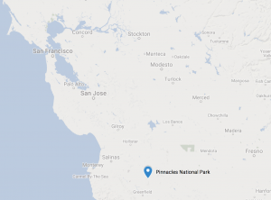
Pinnacles National Park is located about 80 miles south of San Jose to the east of Salinas. Between, the East and West entrances, the East side is the main entrance with the main visitor center and 24 hr access. Because the trail described here is a loop, it’s possible to start out from the west entrance at the Chaparral Trailhead. From the East Bay, it takes about 2 hrs w/o traffic one way. Start out early as the parking lots at the various trailheads fill fast. I would generally advise to arrive by 8AM. Note that there is no road through the park and you cannot drive directly from the east to west entrance.
From the East Bay, take 680S to 101S. About 30 miles depending on where your coming from.
From 101S proceed another 30 miles south to Highway 25, just after Gilroy. Exit Highway 25 going east towards Hollister.
Proceed another 40 miles along Highway 25 to Highway 146. Google Maps may route you through some local roads, but sticking to Highway 25 is probably easier.
Take Highway 146 west into Pinnacles National Park east entrance.
Stop at the Visitor’s center to pay the entrance fee, then continue along 146 further into the park. At the intersection, take the left hand side towards Bear Gulch.
The Trail
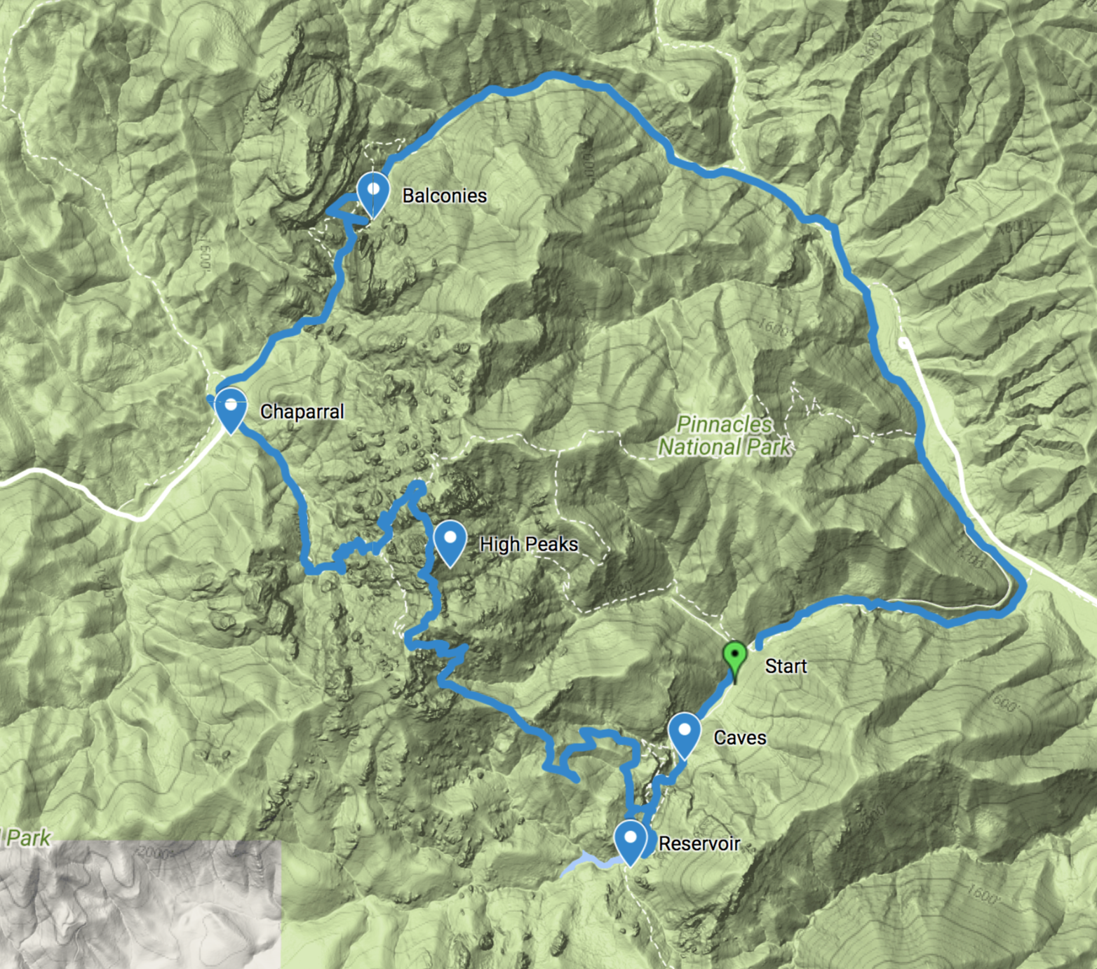
Checkpoint: Start
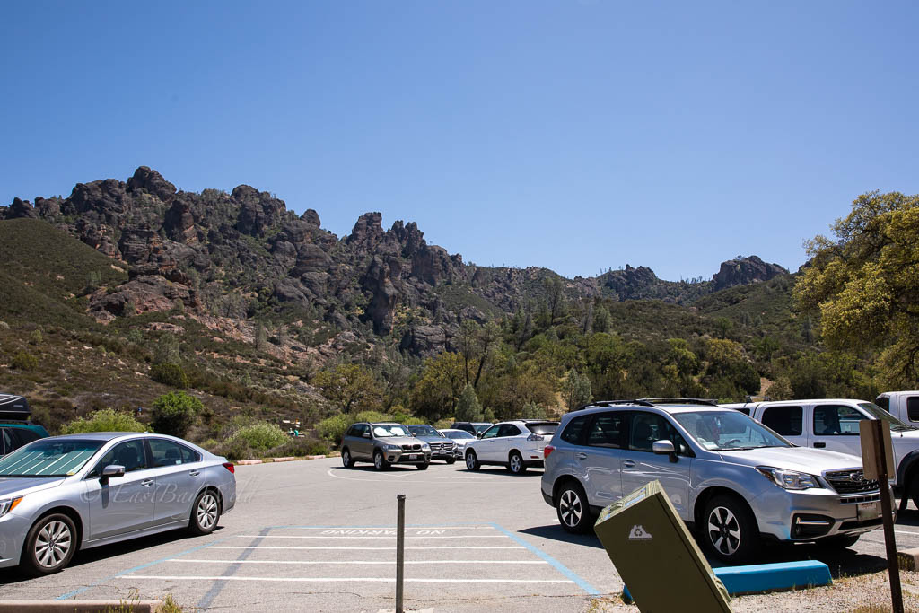
The Bear Gulch trailhead provides a great starting point with a parking lot and restroom facilities.
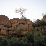
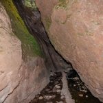
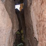
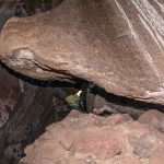
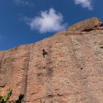
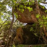
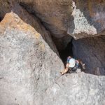
Taking the Bear Gulch Cave trail, you’ll pass by many sheer cliff walls which make Pinnacles a climbers paradise.
The caves are extremely dark and narrow! A headlamp will help you see while using both hands to help stabilize yourself. Large backpacks will have a tough squeeze through some sections.
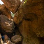
Checkpoint: Bear Gulch Caves
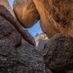
Piled boulders provide a disconcerting ceiling as you weave your way through the darkness.
Checkpoint: Bear Gulch Reservoir
Emerging from the darkness, you’ll be greeted to one of the most scenic views in the park.
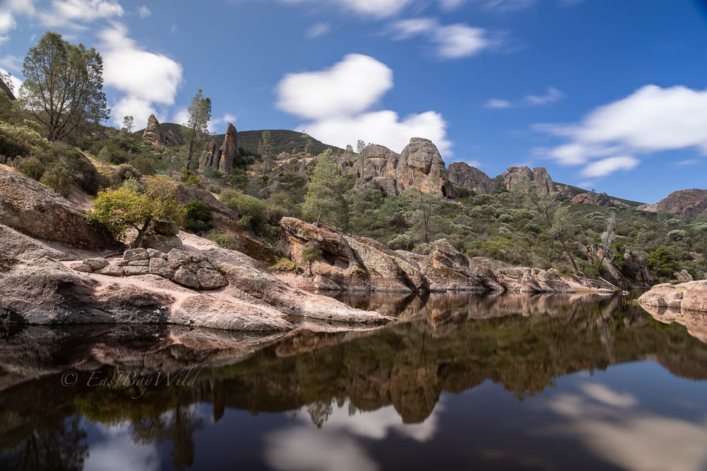
Judging by the aggressiveness of the squirrels, this is a popular spot to have a snack amongst the towering pinnacles and serene waters.
To continue on the trail to High Peaks, you’ll want to stay on the same side of the bridge as the caves and proceed on the Rim Trail that leads upwards into the peaks.
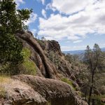
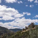
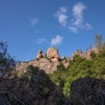
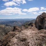
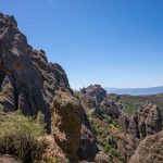
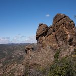
Checkpoint: High Peaks
As the name implies, the trail brings you to the top of the Pinnacles National Park where you can great great views of the both the volcanic structures and sweeping panoramas across the lowlands.
There’s various trails that criss-cross in High Peaks. This guide stays on the High Peaks trail at the first Juniper Canyon trail intersection. It then turns onto the Tunnel Trail which leads back to the Juniper Canyon trail towards the Chaparral Trailhead. This route has a little more elevation gain and tight spaces, but leads you through a closer view of the pinnacles. We were fortunate enough to come across a perched condor midway.
The tunnel trail will begin a descent back down from the peaks but still afford some views of the north-west regions of the park.
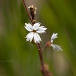
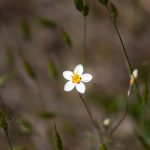
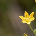
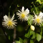
Along the descent on Tunnel and Juniper Canyon trails, you’ll start seeing an increasing variety of wildflowers.
Checkpoint: Chaparral Trailhead
The trailhead offers another great opportunity to take a break, refill on water, and use the restroom.
Checkpoint: Balconies
From the Chaparral Trailhead, take the Balconies trail towards the Balconies Caves/Cliffs.
At the intersection, you can choose either the cliffs or the caves. For this article, we chose the caves.
At the end of the caves or cliffs, proceed along the Old Pinnacles trail to return to the Bear Gulch trailhead.
Conclusion
We’ve held off from doing Pinnacles National Park for a long time due to the distance from the East Bay. Having seen all the unique and wondrous views on this loop trail, we’ll be back to explore the other trails and see if we can glimpse condors in flight!
Similar Hikes
Can’t make it out to Pinnacles? Try these alternates:
- Sunol Regional Wilderness Flag Hill
- Eagles and Turkey Vultures ride the thermals above a prominent rocky outcrop.